Brock Tours & Travel
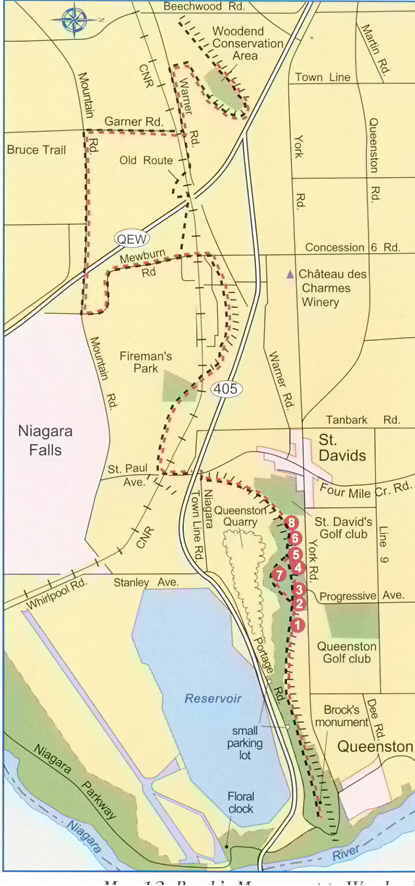
This beautiful 18 kilometre (11 mile) outing is one of our favourite hikes and offers an excellent introduction to the Niagara Escarpment. As a linear route it can be done in either direction, although we will describe it from east to west. There are good picnic facilities and ample parking areas at either end.
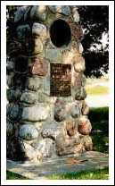 The start is at the Bruce Trail cairn at the east end of Queenston Heights Park. Cross Queenston Heights Park going west along the brow of the escarpment. This first section contains a tour within a tour: the Queenston Trails, which is marked by signposts and provides a wonderful insight into the historical Queenston Quarry. Queenston Trails can be done either on its own or as part of this tour to Woodend. If you only have a short time for a short excursion but you want to capture a flavour of the Niagara Escarpment and some of the history of this area, the Queenston Trails is recommended. The first Queenston Trails signpost occurs at about kilometre 2 (mile 1.2).
The following are highlights that you will encounter walking west along the Bruce Trail.
- View of St. Davids. From here you will have a magnificent panorama of the plain below the escarpment with its orchards, vineyards, and tiled fields that stretch to Lake Ontario on the horizon.
- The Abandoned Tower. This landmark was erected by the Department of National Defence in 1951/52, probably to intercept American radio waves.
- Foundations of Worker's Village. Fourteen houses were built here in 1897 to house workers for the Queenston Quarries.
- These areas show evidence of quarrying activity that preceded the opening of Queenston Quarry in about in 1840. Scottish masons retrieved top quality stones from these locations; the blocks you see are rejects. Quarrying in those early days was done on the edge of the escarpment so the rocks could be easily rolled over the edge.
- This old moss-covered limestone block on the south side of the trail shows evidence of the quarrying method using steel wedges, called plugs and feathers, that were pounded into holes bored into the stone. Large rectangular blocks were split off and shipped throughout eastern Canada.
- In 1882, Isaac Usher & Son opened a cement operation at this site. The Ushers mined into a natural layer of rock cement, fired it in limestone kilns, ground it into a powder, and barrelled the final product. Facing stiff competition from Portland cement., the Usher operation closed in 1905.
- Limestone Caverns. A detour from the main path to visit these caves is well worth the effort. Not only do you get a look at these "caves", which actually have formed largely by quarrying, but you also get a close-up look at the mammoth pot left by Queenston Quarry. A unique feature of the cavern is the flat roof, the petrified mud floor of an ancient shallow sea.
About 3 km (1.8 miles) from the starting cairn, the Bruce Trail descends to the bottom of the escarpment.
Follow the railway bed of the former New York Central Railway, emerging at the intersection of Townline Road and Creek Road {5.5 km or 3.4 miles from the start.}
Go South along Four Mile Creek Road passing under Highway 405. Halfway up the hill turn right into the woods. The trail then enters Fireman's Park {7.4 km or 4.6 miles from the start} which has toilets and parking.
The trail climbs back up the escarpment; when you reach Mewburn Road, head south until you reach Mountain Road. Turn right, crossing the QEW Highway, and proceed to Garner Road {14.9 km or 9.2 miles from the start} Turn right and walk to Warner Road, turn left and go for about 1.0 km (0.6 miles).
As an aside, it should be mentioned that previously the Bruce Trail crossed the QEW Highway via a railway bridge (the old path is shown on the Map). Due to incomprehensible bureaucratic logic, the railway no longer allows right of way across its bridge, causing this very long and boring detour.
Turn right into the woods and proceed past a vineyard to a road that leads into Woodend Conservation area.
Turn right following the trail in a loop around the Woodend Conservation Area.